Are you an outdoor enthusiast looking to explore uncharted territories? If so, mastering the art of using a map and compass is a must. In this article, you will learn the fundamentals of navigating with a map and compass, equipping yourself with the knowledge to confidently find your way through rugged landscapes and unfamiliar territories. Whether you are embarking on a hiking adventure or planning a wilderness backpacking trip, understanding these basic skills will ensure that you never lose your way. So, join us as we embark on a journey to unlock the secrets of map and compass navigation.

Understanding Maps
Maps are essential tools for navigation and understanding the world around us. They provide valuable information about the terrain, landmarks, and routes that we can follow to reach our desired destination. There are different types of maps that serve various purposes, depending on the specific needs of the user.
Different types of maps
One of the most common types of maps is the topographic map. This type of map provides detailed information about the elevation, contours, and features of the land. It is especially useful for hikers, backpackers, and outdoor enthusiasts who need to navigate through challenging terrains. Other types of maps include road maps, city maps, and thematic maps that focus on specific themes such as vegetation or population density.
Map symbols and legends
Maps are filled with symbols and legends that represent various features and elements of the landscape. These symbols allow us to quickly and easily identify landmarks, bodies of water, roads, and other important details. The legend or key is usually located on the map and provides a guide to understanding the meaning of each symbol. By familiarizing yourself with these symbols and legends, you can effectively interpret the information presented on the map.
Scale and distance
Understanding the scale of a map is crucial for accurately interpreting distances and planning your journey. The scale is usually represented as a ratio, such as 1:50,000, which means that one unit on the map represents 50,000 units in the real world. By measuring the length of a line on the map and applying the scale, you can determine the actual distance between two points. This is especially important when calculating the time it will take to travel and estimating the effort required for a particular route.
Orientation and direction
Being able to orient yourself on a map is essential for successful navigation. The orientation of a map refers to aligning it with the true north, which allows you to accurately determine your direction of travel. Most maps are oriented with the top of the page facing north, but it is important to confirm this using a compass. Understanding direction is crucial when planning routes, following trails, and avoiding getting lost in unfamiliar places.
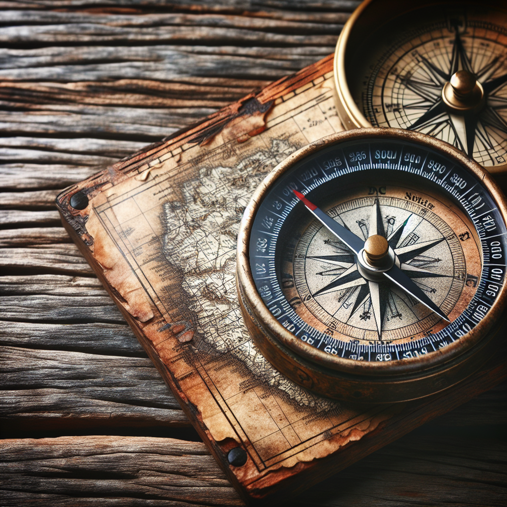
Choosing the Right Compass
Compasses are invaluable tools for navigating with a map. They help you determine your direction and align the map accurately. There are different types of compasses available, each with its own advantages and use cases.
Types of compasses
The most common type of compass used for outdoor navigation is the baseplate compass. This compass has a clear baseplate with rulers and scales, allowing you to measure distances and plot routes on the map. Thumb compasses are often used by competitive orienteers since they are smaller and more convenient to use while running. Lensatic compasses are often preferred by military personnel as they are rugged and reliable. Whichever type of compass you choose, make sure it suits your specific needs and preferences.
Features to consider
When choosing a compass, there are several features to consider. Look for a compass with a liquid-filled housing to ensure the needle remains stable even when moving. A declination adjustment feature is vital as it allows you to compensate for the difference between magnetic north and true north. A rotating bezel or dial is also crucial for taking accurate bearings. Consider the size and weight of the compass, as well as any additional features such as a magnifying glass or luminous markings for easy visibility in low-light conditions.
How to handle and care for a compass
Properly handling and caring for your compass is essential to ensure its accuracy and longevity. Avoid dropping the compass or subjecting it to extreme temperatures. Keep it away from magnetic objects such as cell phones or metal objects, as they can interfere with the needle. Store your compass in a protective case to prevent damage and always clean the lens and dial to maintain clear visibility. Regularly check for any signs of wear and tear, and if necessary, replace the compass to ensure reliable navigation.
Orienting the Map
Orienting the map means aligning it with the compass so that the top of the map corresponds to true north. This is a crucial step in accurate navigation, as it allows you to properly interpret the information presented on the map and plan your routes accordingly.
Aligning the map with the compass
To align the map with the compass, lay the compass on the map so that the direction of travel arrow points towards the top of the map. Rotate the map and compass together until the magnetic needle aligns with the orienting arrow on the compass housing. Once the needle aligns with the arrow, the map is now aligned with the true north. Take care to keep the compass and map flat while aligning them to prevent any errors.
Using landmarks or features
In addition to aligning the map with the compass, using prominent landmarks or features in the landscape can help further verify your orientation. Look for landmarks that are clearly identifiable on both the map and the actual terrain. These can include mountain peaks, distinctive buildings, or even road intersections. By referencing these landmarks on the map, you can ensure that your orientation is accurate and that you have a clear starting point for your navigation.
Using magnetic declination
Magnetic declination is the angle between magnetic north and true north and varies depending on your location. It is important to adjust for magnetic declination to ensure accurate navigation. To determine the declination for your area, consult a local map or research online resources. Once you know the declination angle, use the adjustment feature on your compass to correct for it. By accounting for the declination, you can align the map with the compass more precisely, leading to more accurate navigation.
Using Compass Bearings
Compass bearings are an essential tool for navigating with a map. They allow you to accurately determine your direction of travel and stay on course. Understanding the difference between magnetic north and true north is crucial for using compass bearings effectively.
Understanding magnetic north vs. true north
Magnetic north refers to the direction indicated by the compass needle, which is influenced by the Earth’s magnetic field. True north, on the other hand, is the direction towards the North Pole. The difference between the two is known as magnetic declination, which we discussed earlier. When using compass bearings, it is important to account for this difference to ensure accurate navigation.
Taking a bearing
To take a bearing, hold the compass flat in your hand and align the direction of travel arrow with a specific landmark or target point. Rotate the bezel or dial until the orienting arrow aligns with the magnetic needle. The number or degree indicated by the index line on the bezel or dial is your compass bearing. This bearing can then be used to navigate towards your desired destination.
Following a bearing
Once you have determined your bearing, it is important to keep track of it while navigating. Hold the compass in front of you and make sure the direction of travel arrow points straight ahead. Take note of any landmarks or terrain features that align with your bearing and use them as guide points to stay on track. Periodically check your compass to ensure you are maintaining the correct bearing and make adjustments as necessary.

Reading Contour Lines
Contour lines are an essential component of topographic maps. They provide valuable information about the elevation and shape of the terrain, helping you understand the landscape and plan your routes effectively.
Understanding contour intervals
Contour lines are evenly spaced lines that connect points of equal elevation on a map. The vertical distance between each contour line is known as the contour interval. By understanding the contour interval, you can determine the steepness of slopes and identify key elevation changes on the map. A closely spaced contour interval indicates a steep slope, while widely spaced contours indicate a relatively flat area.
Identifying terrain features
Contour lines can also help you identify and visualize various terrain features. For example, closely spaced contour lines represent steep slopes, while wide-spaced lines indicate flat or gently sloping areas. If contour lines form concentric circles, it suggests a hill or peak. Conversely, contour lines that form a “V” shape represent a valley or depression in the landscape. By interpreting the contour lines, you can gain a better understanding of the terrain and plan your navigation accordingly.
Navigating through elevation changes
Elevation changes can significantly impact your navigation, especially when encountering steep slopes or cliffs. Contour lines provide valuable information about the elevation changes along your route. If you need to ascend or descend a slope, look for contour lines that are closely spaced together, indicating a steep incline. By following contour lines around the slope, you can find a more gradual path to navigate. Taking into account elevation changes can help you avoid difficult or dangerous terrain and choose the path that best suits your abilities and preferences.
Determining Your Location
Knowing your exact location on a map is essential for successful navigation. There are several methods you can use to determine your location accurately.
Using triangulation
Triangulation is a technique that involves using three known landmarks to determine your exact position on the map. Identify three prominent landmarks that are clearly visible on the map and in the actual landscape. Take note of the bearings or directions to each landmark from your current location. Using your compass, take a bearing towards each landmark and draw lines on the map that correspond to these bearings. The point where all three lines intersect is your location.
Using prominent landmarks
If triangulation is not possible or practical, using prominent landmarks can provide a rough estimate of your location. Identify one or more prominent landmarks that are clearly visible on the map and in the actual landscape. Take note of their bearings or directions from your current location. By referencing these landmarks on the map, you can determine your general vicinity and make informed decisions about your navigation.
Reorienting the map periodically
As you navigate through unfamiliar terrain, it is important to periodically reorient the map to ensure your accuracy. Check your compass to confirm your current bearing and compare it to the direction of travel indicated on the map. Adjust the alignment of the map as necessary to ensure it accurately corresponds to your direction of travel. Regularly reorienting the map will help you stay on course and avoid navigation errors.
Navigating with a Map and Compass
Combining the use of a map and compass is the most reliable and effective way to navigate in outdoor environments. By following these steps, you can successfully plan and execute your journey.
Choosing a route
Before setting out, carefully study the map and identify the route that best suits your goals and abilities. Consider the terrain, elevation changes, distance, and potential obstacles along the way. Plan alternate routes in case of unexpected challenges or changes in weather conditions. Choosing the right route is crucial for a safe and enjoyable navigation experience.
Using compass bearings and map measurements
Once you have chosen your route, use your compass and map measurements to ensure you stay on track. Take bearings towards prominent landmarks or waypoints that mark key points along your route. Refer to your map for distance measurements, contour lines, and other important information. By continually cross-referencing your compass bearings with the map, you can confidently navigate through the landscape.
Accounting for obstacles and natural features
As you navigate, it is important to be aware of potential obstacles and natural features that may affect your route. Referencing the contour lines on the map will give you an idea of the terrain ahead, allowing you to anticipate challenges such as steep inclines, water bodies, or dense vegetation. By accounting for these obstacles in your navigation plan, you can make adjustments to ensure a smooth and safe journey.
Using Landmarks and Bearings
Using prominent landmarks as reference points can greatly aid in navigation. By combining landmarks with compass bearings, you can navigate towards specific points more accurately and efficiently.
Identifying key landmarks
When planning your navigation, identify key landmarks that are easily recognizable and visible both on the map and in the actual landscape. These could include mountain peaks, distinctive buildings, or geographic features such as lakes or rivers. By focusing on these landmarks, you can maintain a clear sense of direction and stay on course.
Using bearings to navigate towards a landmark
To navigate towards a specific landmark, take a bearing from your current location using your compass. Align the direction of travel arrow with the landmark and rotate the bezel or dial until the orienting arrow aligns with the magnetic needle. Maintain this bearing as you navigate, keeping in mind any changes in terrain or obstacles. By regularly checking your compass and adjusting your direction if necessary, you can accurately navigate towards your chosen landmark.
Resolving discrepancies and adjusting course
While navigating towards a landmark, it is important to periodically assess your progress and resolve any discrepancies between the map and the actual landscape. Look for recognizable features or waypoints along the way that should align with your map. If you notice any significant deviations, adjust your course accordingly to correct any errors. Regular checkpoints and course adjustments will ensure that you reach your desired destination accurately.
Troubleshooting and Tips
Navigating with a map and compass can present challenges, especially in adverse weather conditions or low visibility. Here are some useful tips for troubleshooting and navigating in difficult situations.
Dealing with poor visibility or darkness
In cases of poor visibility or darkness, navigating with a map and compass can be more challenging. It is crucial to carry a headlamp or flashlight with you to ensure visibility of both the map and compass. Mark key landmarks or waypoints with reflective tape or glow sticks for easier identification in low-light conditions. Consider using a compass with luminous markings or a backlit display to enhance visibility. Always exercise caution and consider turning back or taking shelter in extreme weather conditions.
Using back bearings
Back bearings are bearings taken in the opposite direction to your desired destination. They can be useful for verifying your navigation and ensuring you are staying on course. Take a back bearing by aligning the direction of travel arrow with your destination and rotating the bezel or dial until the orienting arrow aligns with the magnetic needle. This back bearing can then be used to compare with your initial bearing to confirm consistency and accuracy.
Using resection to find your location
If you find yourself unsure of your exact location, resection can help you determine it. Choose two prominent landmarks that you can identify on the map and in the actual landscape. Take bearings towards these landmarks and draw lines on the map that correspond to these bearings. The point where the lines intersect is your location. Resection is a valuable technique when you need to reassess your position and make informed navigation decisions.
Practice and Experience
Using a map and compass proficiently takes practice and experience. Here are some tips to improve your skills and gain confidence in your navigation abilities.
Taking field trips and practicing in familiar areas
Start by planning short field trips to familiar areas where you can practice your navigation skills. Choose routes that are not too challenging initially and gradually increase the difficulty as you gain confidence. Take note of key landmarks, terrain features, and distance measurements to enhance your understanding of the landscape. Practicing in familiar areas allows you to focus on the navigation techniques without the added stress of unfamiliar surroundings.
Gradually increasing the difficulty of navigation
Once you feel comfortable with basic navigation in familiar areas, gradually increase the difficulty level by exploring new and unfamiliar terrains. Choose routes that offer new challenges such as variable elevation, dense vegetation, or complex trail networks. Pushing yourself outside your comfort zone will help you refine your techniques and adapt to different navigation scenarios.
Seeking the guidance of experienced navigators
Learning from experienced navigators can greatly accelerate your progress and help you gain valuable insights. Seek out local orienteering clubs or outdoor communities that offer navigation workshops or training sessions. Participating in group activities or seeking the guidance of experienced instructors can provide you with tips, tricks, and real-world experiences that will enhance your navigation skills. Don’t hesitate to ask questions, observe, and learn from those who have mastered the art of map and compass navigation.
Navigating with a map and compass is both an art and a science. With practice, patience, and determination, you can become a proficient navigator and explore the world with confidence and independence. Remember that the journey is just as important as the destination, and enjoy the process of mastering this timeless skill. Happy navigating!